 New Iraq Enterprises, Quetta, Balochistan 87300
")
GeoGis
Windows Software
Stonex GeoGis is a powerful yet simple software solution for the collection of high quality feature and position data for GIS update and maintenance. GeoGis software provides simple and efficient workflows to capture high quality data quickly and easily. GeoGis is an option that can be embedded into handheld GIS systems.
GeoGis is developed for Windows Mobile.
![]()
Windows Software
Stonex GeoGis is a powerful yet simple software solution for the collection of high quality feature and position data for GIS update and maintenance. GeoGis software provides simple and efficient workflows to capture high quality data quickly and easily. GeoGis is an option that can be embedded into handheld GIS systems.
GeoGis is developed for Windows Mobile.
DESCRIPTION
GeoGis software consists of two integrated modules: GeoGis Mobile for the field work and GeoGis Office for desktop elaboration. With GeoGis you never have to worry about which application to use to manage and transfer your data. With GeoGis software the workflow is straight and simple, from the field to the office and vice versa.
Stonex GeoGis software makes the field data collection fast and easy to do thanks to a full set of field-designed features, such as graphical map display, clear icon toolbar and useful calculation tools. Stonex GeoGis software also makes it easy to incorporate digital photos into the data collection workflow using an handheld with integrated digital camera. Field workers can take and preview photos, attaching them to the features and create complete set of data for many different purposes.
With Stonex GeoGis software you can create custom data attributes and use them to assign values to the assets. Data forms can be pre-compiled basing on previously entered attribute values for maximum data collection efficiency.
Assets can be viewed on the intuitive graphical display, overlapped with raster and vector backgrounds, resulting in increased productivity and creating a more dynamic field worker experience. Thanks to cellular and Wi-Fi capability GeoGis software can display online maps such as Google Maps, expanding the ability to find visual reference points anywhere on the planet. To inspect an asset, field workers can select the corresponding feature from the list or map, and the intuitive navigation tool of the GeoGis software will guide them to the asset’s precise location.
With Stonex GeoGis software, you can collect data with the required level of accuracy, either in real time or after postprocessing. Stonex GeoGis software is the right solution for collecting and maintaining high quality GIS data.
Geogis is available in the following languages: English, Spanish, Czech, Italian, Hungarian, German, Portuguese, Russian and Uzbek ( Turkish in progress).
Related products
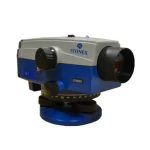
Stonex Digital Level D1
STONEX D1 digital autolevel is the recommended leveling instrument for contractors, builders, professionals land surveyors and Engineers who demand accurate leveling every time. The accuracy of ± 1.5 mm on a base of 1 Km – double run – makes STONEX D1 the perfect equipment for the 3rd order leveling and for construction industry. Faster automatic measurements – difference in height and distance – are digitally determined: the fully electronic measurement results appear in the clearly visible display window after less than 2 seconds.
![]()
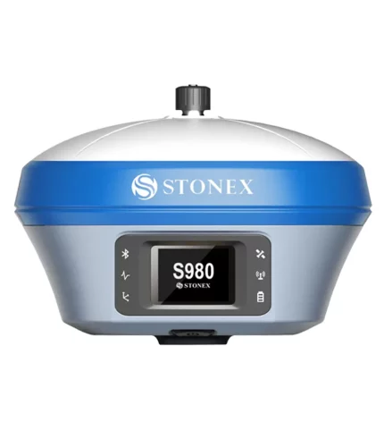
S980 GNSS Receiver
The perfect base GNSS receiver
Stonex S980 integrated GNSS receiver tracks all the present constellations and satellite signals GPS, GLONASS, BEIDOU, GALILEO, QZSS and IRNSS.
Through the 4G GSM modem a fast internet connection is guaranteed and the Bluetooth and Wi-Fi modules allow always reliable data flow to the controller. These features combined with the integrated 2-5 watt radio make S980 the perfect base station receiver.
![]()
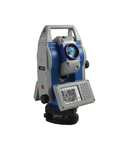
R35/R35LR Total Station
Stonex R35/R35LR series is the most customizable Total Station of the market. Depending on the User needs, R35/R35LR comes with endless friction drives for continuous horizontal and vertical rotations, 2” accuracy and 600/1000 m reflectorless range.
This advanced Total Station is fully customizable: each user can choose the software that best suits own needs. Several onboard software to be choosen, such as Microsurvey FieldGenius, Carlson SurvCE, ANTAS Mobile and many Custom field applications.
![]()
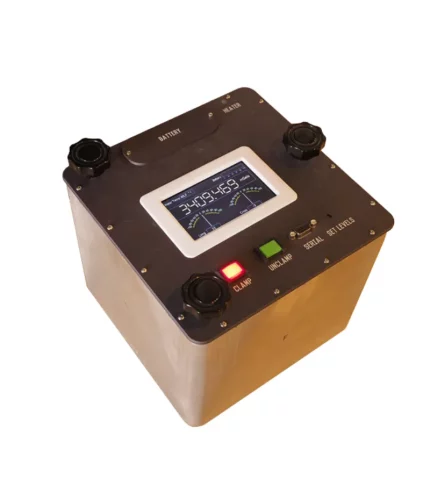
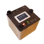
Dynamic gravity Systems AT1-L
Windows Software
Stonex GeoGis is a powerful yet simple software solution for the collection of high quality feature and position data for GIS update and maintenance. GeoGis software provides simple and efficient workflows to capture high quality data quickly and easily. GeoGis is an option that can be embedded into handheld GIS systems.
GeoGis is developed for Windows Mobile.

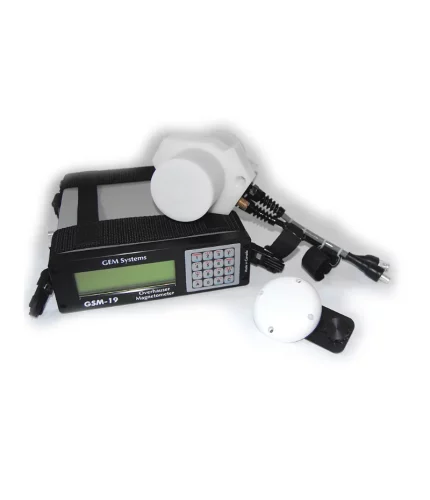
GEM GSM-19 Cost Effective and High Precision Overhauser Magnetometer
GEM’s Overhauser Magnetometer system is a revolutionary geophysical instrument developed by GEM to offer a rugged, low power, and sensitive alternative to Proton Precession and some other alkali vapour magnetometers.
GEM’s GSM-19 (Overhauser) magnetometer is a primary standard in mineral exploration and magnetic observatories. As a standard for magnetic observatories, this system has proven itself – for its high sensitivity, absolute accuracy and long life. Overhauser magnetometers are also used in archaeology, pipeline mapping, UXO detection, and other engineering and environmental applications.
