 New Iraq Enterprises, Quetta, Balochistan 87300
")
GEM GSM-19 Cost Effective and High Precision Overhauser Magnetometer
GEM’s Overhauser Magnetometer system is a revolutionary geophysical instrument developed by GEM to offer a rugged, low power, and sensitive alternative to Proton Precession and some other alkali vapour magnetometers.
GEM’s GSM-19 (Overhauser) magnetometer is a primary standard in mineral exploration and magnetic observatories. As a standard for magnetic observatories, this system has proven itself – for its high sensitivity, absolute accuracy and long life. Overhauser magnetometers are also used in archaeology, pipeline mapping, UXO detection, and other engineering and environmental applications.

Overhauser Benefits
The GSM-19 is our mid-range instrument with excellent benefits for subsurface exploration. The Overhauser system offers an order-of-magnitude increase in sensitivity over GEM’s Proton system and matching sensitivities of some alkali devices. With data quality exceeding the standard proton precession, and comparable to the costlier optically pumped cesium magnetometer systems, the GSM-19 is a standard for many applications.
Overhauser magnetometers also provide high absolute accuracy, ruggedness, and reliability – as numerous systems are in operation around the world with an excellent performance record so that the GSM-19 can be counted on in any situation. Early versions of the Overhauser, developed in 1983, are still running on a continuous basis at an observatory in Japan.
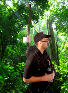
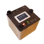
GEM’s Overhauser Magnetometer with GPS sensor (top),
console, and backpack. The system is extremely light
and robust – making it an ideal choice for many
subsurface investigations.
Overhauser offers the option of pulsed versus continuous operation. With pulsed operation, the system provides an energizing pulse to initiate the reading. With continuous operation, the system is always active – so that data can be recorded conveniently anywhere, at any time.
GEM’s Overhauser magnetometer/gradiometer also offers much less power consumption than Proton or alkali vapour systems so you can perform a whole day’s work on a single charge. Optional benefits include an omni-directional sensor (i.e. no dead zones) and fast sampling. Fast sampling of up to 5 Hz is available – an important capability for many larger surveys. This fast sampling gives the option to automate readings on a vehicle such as an all-terrain-vehicle (ATV), snowmobile sled, etc.
The Overhauser Magnetometer does not require maintenance – it is as robust and effective an instrument as ever made for the field. It also has superior environmental specifications, which include an operating temperature of -40°C to +50°C; giving unparalleled performance throughout all survey conditions.
The cables and connectors have been carefully selected for maximum durability and performance. The light weight backpack gives hands-free operation while ensuring a stable, comfortable, and lightweight platform for making measurements.
Integrated GPS
Not only do our GPS technologies tell you where you have been, but they tell you where you need to go. This allows for highly accurate readings via ‘Waypoint Programming’ as well as accurate time synchronization for base station corrections.
With Waypoints, you design your survey on your personal computer and import the stations with ease into the magnetometer console. Then, the system will guide you to each Waypoint where a reading is to be made. With ‘Walking’ mode, you have a nearly continuous record of GPS-referenced data points – a major advantage in surveying because you save time in the field and it eliminates the possibility of positioning mistakes.
Specifications
Sensitivity: 0.022 nT @ 1 Hz, (0.015 nT option)
Resolution: 0.01 nT
Absolute Accuracy: +/- 0.1 nT
Dynamic Range: 20,000 to 120,000 nT
Gradient Tolerance: Over 10,000 nT/m
Sampling Intervals: 60+, 5, 3, 2, 1, 0.5, 0.2 sec
Operating Temperature: -40°C to +50°C
Related products
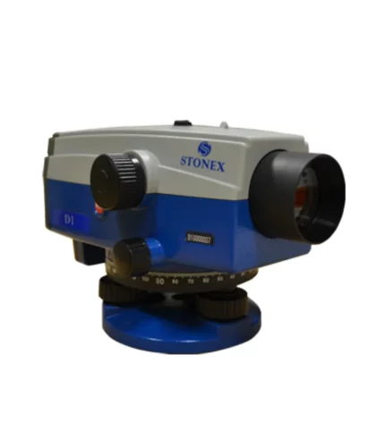
Stonex Digital Level D1
STONEX D1 digital autolevel is the recommended leveling instrument for contractors, builders, professionals land surveyors and Engineers who demand accurate leveling every time. The accuracy of ± 1.5 mm on a base of 1 Km – double run – makes STONEX D1 the perfect equipment for the 3rd order leveling and for construction industry. Faster automatic measurements – difference in height and distance – are digitally determined: the fully electronic measurement results appear in the clearly visible display window after less than 2 seconds.
![]()
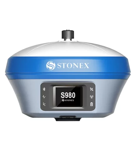
S980 GNSS Receiver
The perfect base GNSS receiver
Stonex S980 integrated GNSS receiver tracks all the present constellations and satellite signals GPS, GLONASS, BEIDOU, GALILEO, QZSS and IRNSS.
Through the 4G GSM modem a fast internet connection is guaranteed and the Bluetooth and Wi-Fi modules allow always reliable data flow to the controller. These features combined with the integrated 2-5 watt radio make S980 the perfect base station receiver.
![]()
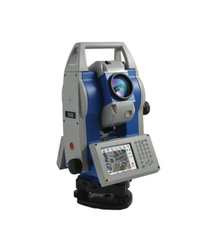
R35/R35LR Total Station
Stonex R35/R35LR series is the most customizable Total Station of the market. Depending on the User needs, R35/R35LR comes with endless friction drives for continuous horizontal and vertical rotations, 2” accuracy and 600/1000 m reflectorless range.
This advanced Total Station is fully customizable: each user can choose the software that best suits own needs. Several onboard software to be choosen, such as Microsurvey FieldGenius, Carlson SurvCE, ANTAS Mobile and many Custom field applications.
![]()
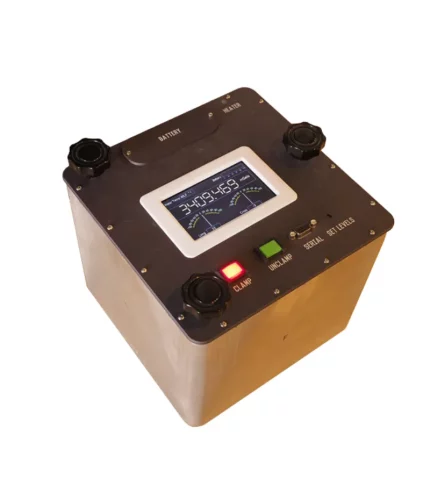
Dynamic gravity Systems AT1-L
Windows Software
Stonex GeoGis is a powerful yet simple software solution for the collection of high quality feature and position data for GIS update and maintenance. GeoGis software provides simple and efficient workflows to capture high quality data quickly and easily. GeoGis is an option that can be embedded into handheld GIS systems.
GeoGis is developed for Windows Mobile.

GeoGis
Windows Software
Stonex GeoGis is a powerful yet simple software solution for the collection of high quality feature and position data for GIS update and maintenance. GeoGis software provides simple and efficient workflows to capture high quality data quickly and easily. GeoGis is an option that can be embedded into handheld GIS systems.
GeoGis is developed for Windows Mobile.
![]()